
The Story Behind Oregon’s Floodplain Neighborhoods
The Story Behind Oregon’s Floodplain Neighborhoods
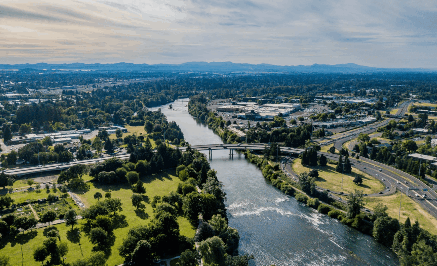
Take a drive through some of Oregon’s most charming neighborhoods and you might notice a curious theme: many of them hug the edges of rivers, creeks, and streams. These aren’t just pretty spots for a picnic—they’re living chapters of Oregon’s history, shaped by both human ambition and the unpredictable moods of water.
Settling by the Water: Roots of a Risky Romance
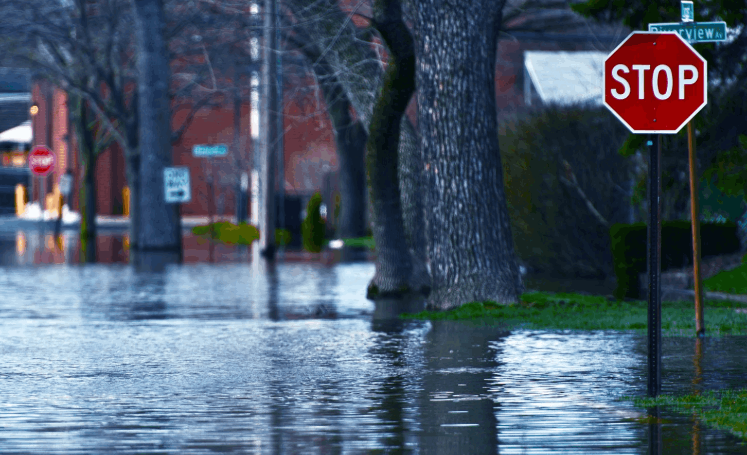
Long before zoning laws and FEMA flood maps, settlers in Oregon were drawn to riverbanks like moths to a flame. Water meant survival: it powered mills, irrigated crops, and provided easy transportation. Towns like Eugene, Salem, and Portland blossomed where rivers met, their economies fueled by the promise of commerce and fertile land. The risk? Well, that was just part of the deal. Floods were seen as acts of nature—unavoidable, but worth the gamble for the bounty the rivers offered.
Why Build in the Floodplain?
It wasn’t just about the view. Early Oregonians built in floodplains out of necessity and opportunity. Rivers were the highways of the 1800s. If your home or business was close to the water, you had an edge—goods could be shipped, crops irrigated, and communities connected. Sure, the floods came, but so did the silt, making the soil richer each year. For many, the trade-off was a no-brainer.
The Evolution of Flood Maps: From Guesswork to Science
For decades, flood risk was measured by memory and folklore—"Remember the big one in ‘48?" But as Oregon grew, so did the need for better information. Enter the first official flood maps, crude at first but increasingly sophisticated as technology advanced. Today, FEMA’s digital flood insurance rate maps (FIRMs) use satellite data, hydrology models, and historical records to pinpoint risk zones. But these maps are snapshots in time, not guarantees. Rivers change course. Climate patterns shift. And that’s where modern homebuyers need to be savvy.

What Every Buyer Needs to Know (and Check!)
- Don’t just trust the listing: Always check the latest FEMA flood maps yourself. Local city or county planning departments can offer even more up-to-date info.
- Ask about flood insurance: Even if it’s not required, premiums can be steep and policies may have exclusions. Shop around and read the fine print.
- Understand the history: Has the property flooded before? Sellers are supposed to disclose, but public records and neighbors can fill in the blanks.
- Look for mitigation: Elevation, sump pumps, and engineered landscaping can all reduce risk—and sometimes mean lower insurance costs.
Floodplain neighborhoods are a testament to the Oregon spirit: a little rebellious, a little risky, and always shaped by the land (and water) itself. If you’re drawn to the beauty and history of these river-hugging communities, do your homework. Because in Oregon, the story of a home is often written by the water that runs beside it.
Categories
- All Blogs (153)
- Divorce (5)
- Downsizing (6)
- Eco-Friendly Living (4)
- Explore Oregon (39)
- Food (1)
- Home Buying (95)
- Home Maintenance (26)
- Home Selling (54)
- Home Styling & Staging (2)
- Join REAL (11)
- LGBTQIA+ (11)
- My Life (4)
- Neighborhoods (23)
- PNW Gardening (9)
- Real Estate History (14)
- Relocation (42)
- Veteran Loans (1)
Recent Posts


LET'S CHAT